RISKS AND RISK MANAGEMENT
In an effort to improve understanding of disaster risks in Europe, the European Commission publishes the overview of natural and human-induced disaster risks that the EU may face to identify and examine trends in the ever-evolving disaster risk landscape. This report supports better understanding of disaster risks that Europe’s population is facing and informs decision makers on risk management as a mean to prevent loss of life and avoid any negative economic, social and environmental impacts.

The Disaster Risk Management Knowledge Centre pursues:
The Disaster Risk Management Knowledge Centre (DRMKC) was launched on 30th September 2015 to help enhance EU and Member States’ resilience to disasters and their capacity to prevent, prepare and respond to emergencies through a strengthened interface between science and policy.
Another hazard that has contributed to substantial loss of life in the past are heatwaves. Heatwaves accounted for…… of the 91 455 fatalities caused by weather-related and geophysical disasters in the EU over the period 1980- 2017.
Most of these fatalities were recorded during two heatwaves that occurred in 2003 and 2013.
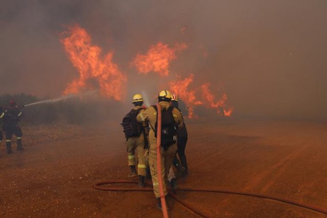
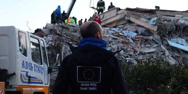
In August 2021, Greece activated the EU Civil Protection Mechanism to launch the largest firefighting operation throughout its 20 years of existence. The EU-coordinated firefighting operation helped Greece tackle forest fires active in various locations.
© Hellenic Fire Corps, 2021 (photographer: George Chionidis)
But how does the EU prepare for this year’s forest fire season?
All of the above. Forest fires pose a significant disaster risk to Europe as a whole, as well as to other parts of the world. They damage ecosystems, destroy woodlands and devastate the lives of many Europeans.
Over the past years, fires have ravaged forests and ruined protected sites across the European Union.
© European Union 2021 (photographer: Sotiris Dimitropoulos)
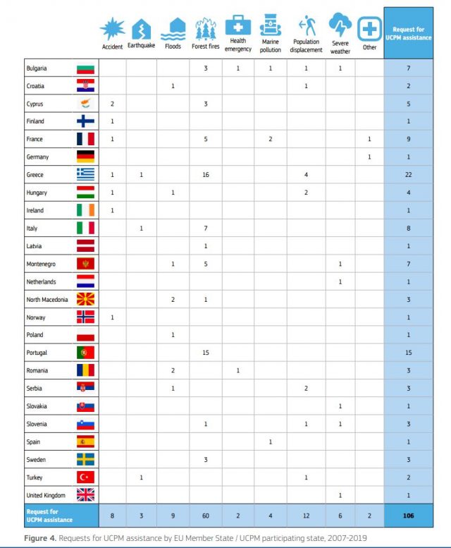
Between 2007 and 2021, over … of all requests for assistance through the EU Civil Protection Mechanism were in response to wildfires.
The fire risk is expected to further increase due to climate change. The season will be increasingly characterised by massive fires that cost lives and burn areas that take longer to fully recover. Between 2007 and 2021, over 17% of all requests for assistance through the EU Civil Protection Mechanism were in response to wildfires.
Wildfires have recently become a pan-European concern. Although France, Spain and Portugal were particularly hit last summer, major fires also took place in Czech Republic, Germany, Greece, and Slovenia, to name a few.
In total, 20 EU Member States recorded more burned areas than average in 2022. The wildfire risk expanded to areas that have not previously been exposed, moving well beyond the Mediterranean region. This later fact causes huge societal, environmental and economic losses across Europe and affects the climate.
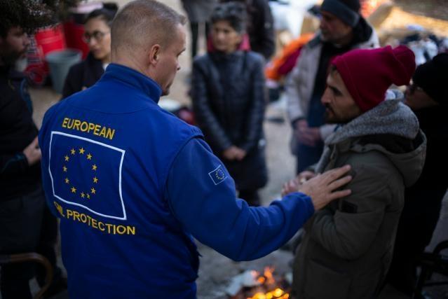
More than 200 firefighters from Bulgaria, Finland, France, Germany, Romania and Norway were positioned in Greece to allow for immediate support to Greek first responders in case of large wildfires. Together with the Greek Fire Service, they did trainings, exercises and knowledge sharing activities. They also participated in several fire interventions.
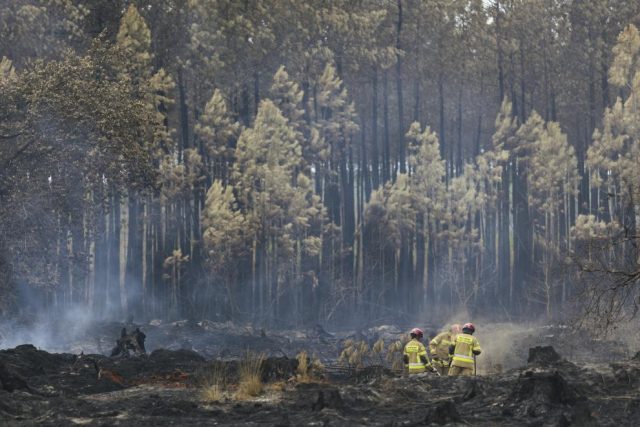
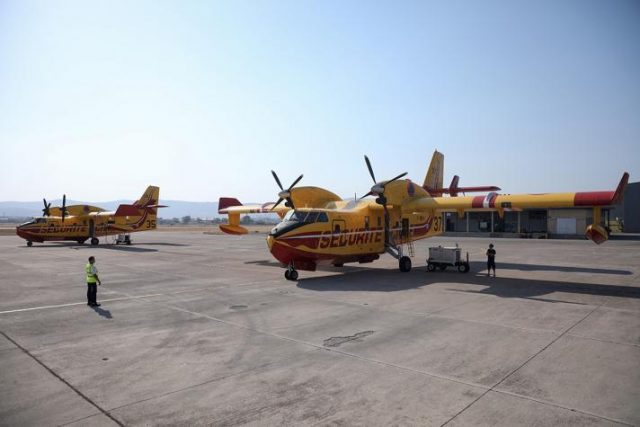
In August 2022, several devastating fires burned large areas of forest in France and forced people to flee their homes.© European Union, 2022
© European Union, 2022
Fact: The 2018 Attica forest fires in Greece killed 102 people and burnt 1 276 ha. These have been the second deadliest wildfires of the 21st century so far, after the 2009 Black Saturday bushfires in Australia that killed 180 people.
It is estimated that earthquakes are responsible for about … of the economic losses generated by natural disasters.
Earthquakes are the natural hazard that generates the largest number of human casualties in the modern society. Likewise, it is estimated that they are responsible for about 35% of the economic losses generated by natural disasters. Tsunamis are among the natural hazards that can result in the largest number of victims per event. While the earthquakes that cause them cannot be predicted, it is possible to provide early warning about tsunamis if there is enough distance between the seismic source and the coast. To mitigate the effects of earthquakes and tsunamis, the Joint Research Centre develops tools and methods to support efficient disaster management, from the early warning phase through to recovery and reconstruction.
Unfortunately, field missions, when it comes to earthquakes cannot be organised.
Field missions are organised in concerted collaboration with international partners, universities and national services in the affected countries and other Departments of the European Commission. The aim is to collect information on the performance of buildings and infrastructure, socio-economic aspects and the management of the disaster. Attention is also given to rural and less developed regions as well as to cultural heritage. Field data is complemented with information obtained through remote sensing techniques that combine pre-earthquake satellite images and post-earthquake aerial photos. The collected material is used to improve the design methods for new structures and the techniques for strengthening and retrofitting, to draft guidelines for the construction of safe non-engineered houses and to assist the management of the post-event and reconstruction phase.
https://joint-research-centre.ec.europa.eu/scientific-activities-z/earthquakes-and-tsunamis_en
Did you know that there is an operational European system monitoring and forecasting floods across Europe?
The European Flood Awareness Systems (EFAS) is the first operational pan-European flood forecasting and monitoring system that provides a wide range of early flood forecasting information to support national and regional authorities with flood risk management duties in arranging preparatory measures before an event strikes.
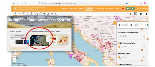
(Source: https://confluence.ecmwf.int/display/CEMS/3.2+EFAS+Map+Viewer)
https://www.efas.eu/en/european-flood-awareness-system-efas
In addition, EFAS alerts Member States to potential flood risks up to ten days in advance.
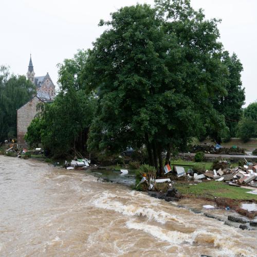
Fact:
Almost 1500 flood events in Europe since 1980
Over 4300 deaths caused by flood events
More than €170 billion economic damage caused by flood events since 1980
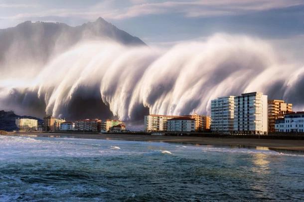
While the earthquakes that cause tsunamis cannot be predicted, it is not possible to provide early warning about tsunamis.
It is possible to provide early warning about tsunamis if there is enough distance between the seismic source and the coast. To mitigate the effects of tsunamis, the JRC develops tools and methods to support efficient disaster management, from the early warning phase through to recovery and reconstruction.
https://joint-research-centre.ec.europa.eu/scientific-activities-z/earthquakes-and-tsunamis_en

The Kos marina, popular with holidaymakers, was hit by a tsunami in 2017
© olezzo, adobe stock 2019
© Mimadeo / Shutterstock.com
https://www.unesco.org/en/tsunami-warning-system-preparing-unpredictable